More Sedona Hiking Trail Adventures
Schnebly Hill Trail
The Schnebly Hill Trail climbs moderately up the west face of Schnebly Hill. There are some magnificent red rock views for the first 0.75 miles. Once you have gone 1.25 miles, where the roadbed turns sharply to the left, take the trail on the right which is signed "Munds, Jacks, Hot Loop". It climbs moderately for nearly 0.75 mile, passing through 2 cattle gates, and opens on a large, open expanse near Committee Tank. There are several overlooks offering great views of Munds Mountain, Bear Wallow Canyon and the red rock formations beyond. The trail is level for the next quarter mile and then descends to a saddle separating Schnebly Hill and Munds Mountain at the head of Jacks Canyon. Just before reaching the saddle, there is a signed trailhead on the left for Hot Loop. Continue down another 150 yards where there are two more signed trailheads. The Jacks Canyon Trail leads down to the left.
The Munds Mountain Trail begins here and continues ahead, beginning a steep, switchback ascent, climbing 500 feet in a little over a half-mile. There are fine views over Jacks Canyon and the rim country all the way to the San Francisco Peaks near Flagstaff. The trail flattens out as it emerges on the broad, open, flat expanse of the mountain top. The trail continues on, but it is never close to the edge and views are limited, so this is a good place to turn around.
Length: 3.1 miles one-way (as described); rating – strenuous; season-year round; hiking time - 4 hours roundtrip
Location: From the junction of Routes 89A and 179, take 179 south 0.3 miles. Turn left on Schnebly Hill Road just past the Oak Creek Bridge and go 5 miles (0.6 miles beyond the winter closure gate) to a turnout on the left. Park and walk 100 yards down the road to the signed trailhead for Schnebly Hill Trail on the east side.
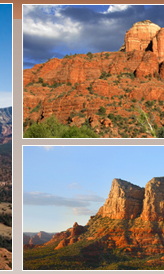
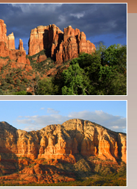
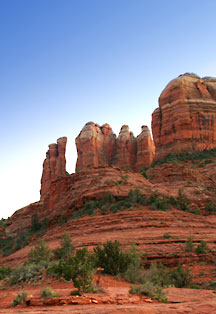
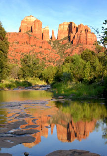
Cathedral Rock Trail
Cathedral Rock Trail, more of a rock climb than a hike, this trail is steep and difficult in places. Follow the basket cairns across the wash and up the moderate slope toward the spires. At 0.25 mile, the trail emerges on a broad ledge with great views. It ascends steeply over bald rock and in a shallow cleft with a few toeholds notched into the rock to help on the steeper places.
Emerging on a small knob, cairns show the way up and across several ledges toward the deep drainage ahead which it follows, climbing moderately steeply to the top of a wide saddle between two spires. Wonderful views are all along, but the most spectacular from the top. An unmaintained path leads south along the west base of the spires giving access, with short climbs, to two more saddles between sheer rock faces and a close-up view of an exposed lava dike at the first. Return by the same route for a 1.5 mile hike.
Length: 0.7 miles; rating – moderate; season – all year; hiking time – 1-2 hours
Location: From the junction of Routes 89A and 179, take 179 south 3.5 miles to Back-O'Beyond Road on the right. Go 0.6 miles to the trailhead parking turnout on the left.
Nearby Sedona Hiking Trails |